Village and Municipality

Freguesia da Nazaré, Famalicão dista apenas 8 km da sede de concelho. No sopé da Serra da Pescaria e rodeada de férteis campos, a povoação, com uma área de 21,8 Km2 e cerca de 1.700 habitantes, é atravessada pela linha do Oeste (CP).
Essentially rural and agricultural in nature, Famalicão has its settlement linked to the inhabitants of Paredes da Vitória, who in the early 16th century came to settle here, bringing with them the cult of Our Lady of Victory, which caused friction between new and old residents. At that time, the village was divided into Famalicão de Baixo, which belonged to Alfeizerão, and Famalicão de Cima, which belonged to Pederneira, and to which the inhabitants of Paredes came.
Until the 18th century this division was maintained, when the conflict between the two was “won” by Famalicão de Cima, unifying into a single village, which began to grow as a parish, under the protection of its patron – Our Lady of Victory – celebrated every year in August.
Like Pederneira, Famalicão was also part of the Cistercian domains, having been a vicar of the Monastery of Alcobaça, later becoming a priory.
Currently, Famalicão is a village in continuous development, whose economic base is agriculture and fruit production, with the wood fibre and ceramics industry being a pole of growth in the parish.
The still undiscovered beauty of Serra da Pescaria and Praia do Salgado are an asset to the land and a tourist spot to know, especially for lovers of sport fishing, nature and hiking.
Village located 6 km away from Nazaré, next to the Oeste railway line and the access point to the A8 motorway, it is the second largest parish of the municipality, with around 3,100 inhabitants, spread over 18.37 km2.
Archaeological finds attest to the Roman occupation of the area; however, the settlement of the village seems to have only actually started in the 13th century, with the draining of Paúl da Cela (bogland) at the request of King D. Dinis.
Valado belonged to Pederneira, and was therefore within the lands of the Coutos de Alcobaça, having therefore been populated and developed by the Cistercians monks.
The origin of the name Valado derives from “veiled” or “to watch”, as there was a monk in charge of watching over the fields belonging to the Monastery, according to the opinion of some scholars; according to others, the toponym derives from “vallo” or “vallu”, a Latin word that can mean both defence and irrigation work or land division.
A presença dos frades deixou marcas visíveis na vila, para além do nome da localidade. Foram os cistercienses os grandes impulsionadores da drenagem dos campos (antigos pântanos e pauis, deixados pelo recuo do mar, que outrora cobrira a região), e da sua adaptação à agricultura. Aqui instalaram uma das 10 granjas agrícolas dos Coutos, na qual fundaram, no século XIV, uma “Escola de Engenharia Hidráulica e Agrícola”, na Quinta do Campo – hoje transformada numa belíssima unidade de turismo de habitação.
O Valado actual é uma vila dinâmica, onde a exploração agrícola intensiva de minifúndios é a base económica da população, sendo a indústria da cerâmica, porcelana e faiança (utilitária e decorativa), o outro grande pólo de desenvolvimento da freguesia. A instalação de uma Área de Localização Empresarial veio dar uma novo impulso económico à vila, criando ao mesmo tempo vários postos de trabalho.
Sporty and socially very active, the village has the necessary infrastructure to practice various sports: roller hockey; skating; basketball and indoor soccer. Cultural and recreational associations play an important role in the lives of the people from Valado.
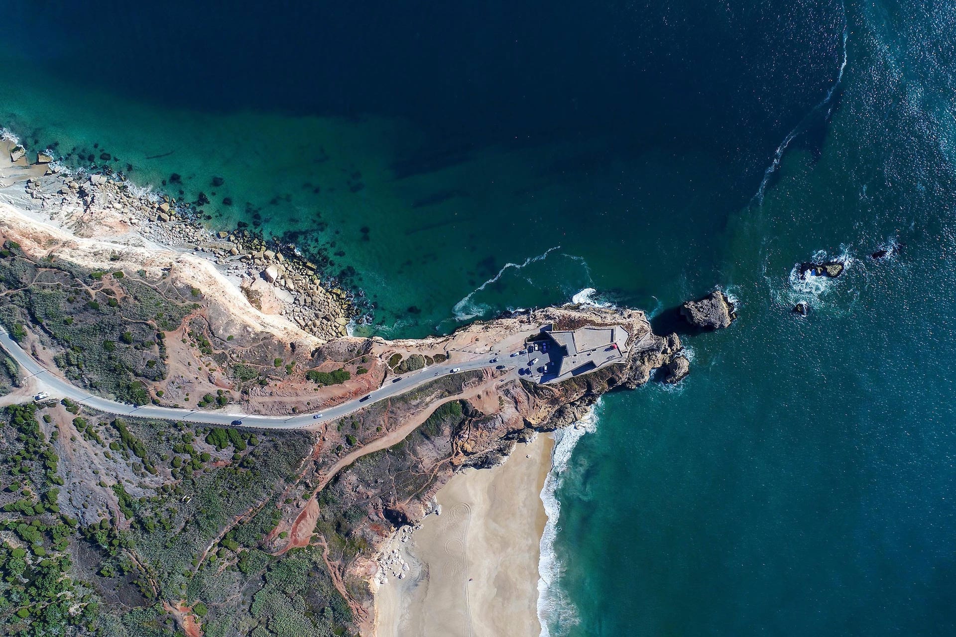
O Sítio, no alto do Promontório, a 110 metros de altitude, abre-se a um dos mais belos panoramas marítimos de Portugal.
Genesis of the town's name, a place of miracle, worship and pilgrimage since at least the 14th century, Sítio developed as a village only in the middle of the 17th century due to difficult access, having grown considerably during the following century.
The installation of a Funicular linking “Praia” to “Sítio”, in 1889, originated a new population increase as well as tourist visits.
O longo promontório que guarda e protege a Praia tem no seu extremo o Forte de S. Miguel Arcanjo. O Sítio dos nosso dias conhece novas peregrinações, entre Outubro e Março, de todos os amantes e curiosos de ver as Maiores Ondas do Mundo.
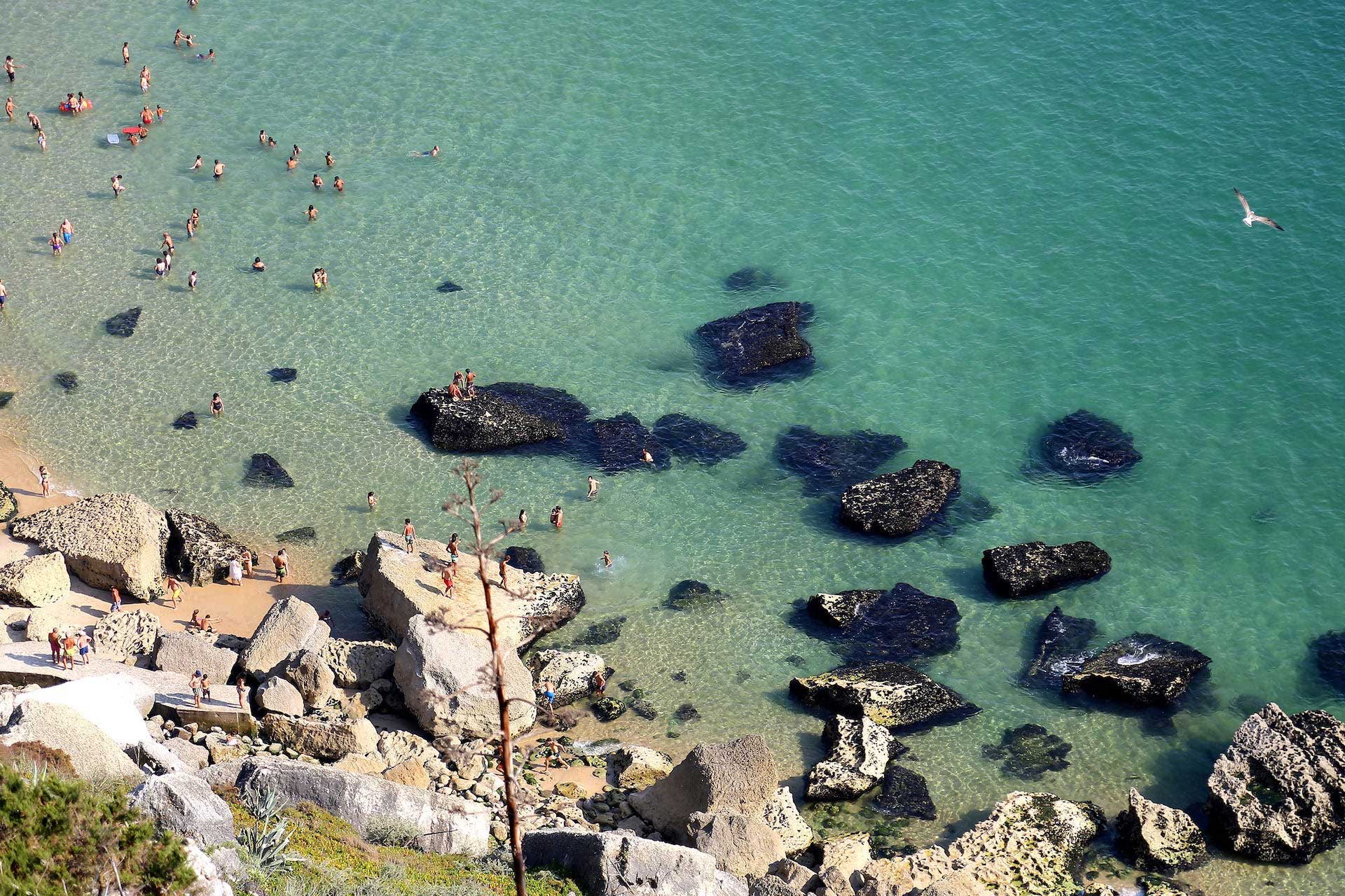
The beach of Nazaré has a relatively recent origin, for until the 17th century the sea occupied most of the area where today stand the houses. The geological transformations occurred during that century made the retreat of the sea and the silting up of the area, leaving the lovely bay uncovered.
The first references to fishing in Nazaré date from 1643, however, only in the beginning of the 19th century did the population start to live in the new beach. Until then, the fishermen lived, mainly, in the upper parts – Sítio and Pederneira – since the constant attacks of Algerian and Dutch pirates made the beach a very unsafe place.
Nazaré was first known and demanded as a seaside resort in the middle of the 19th century. Its natural beauty and typical characteristics drew the visitors’ attention. Fishing, fish transformation and its sale were the main activities of the population during most of the 20th century.
The harsh and dangerous sea life has made many fishermen leave their hometown seeking for better living conditions. The construction of the Harbour, in the 1980s, has changed and improved the fishermen’s living conditions, thus starting a new period on the population’s daily life. In the 1960s, tourism discovered the charm of the beach and the town became known all over the world.
Every year, Nazaré receives the visit of thousands of national and international tourists, being today a modern and always lively town. To walk down its narrow streets towards the sea, is to discover a way of living still genuine and peculiar, with surprises at every corner! Beauty, memories, charisma and traditions make Nazaré the most unforgettable Portuguese beach.
Terra de pescadores desde o século XII, a Pederneira era então denominada Seno Petronero, que significa Golfo da Pederneira. Situava-se, nessa época, mais para o interior e era a pesca na Lagoa a fonte de riqueza da vila. Desenvolvida, no final do século XV, com a chegada dos pescadores da assoreada e despovoada vila de Paredes, foi um dos mais importantes portos de mar dos Coutos do Mosteiro de Alcobaça.
Sede de concelho, a Pederneira era, a seguir a Alcobaça, a vila mais populosa e produtiva dos domínios de Cister.
O Rei D. Manuel I concedeu-lhe Foral em 1514. Na época áurea dos Descobrimentos Portugueses – séculos XV e XVI – foi um dos mais activos estaleiros navais do reino, de onde saíram muitas naus e caravelas. Pelo porto da Pederneira eram escoadas mercadorias e as madeiras do Pinhal do Rei, para a capital e além-mar.
Da sua população de pescadores foram recrutados muitos bravos marinheiros, destacando-se o mítico calafate e mareante Bastião Fernandes, que terá sido marinheiro na Rota das Índias.
The development of Sítio and the progressive drawback of the sea due to the silting up of the gulf, and the formation of the new beach, led to the decline of Pederneira in the end of the 18th century. Not even the arrival of fishermen from the area of the Aveiro Ria was enough to give it some vitality. Slowly the inhabitants moved to the new bay.
Nowadays, Pederneira is one of the town centres, peaceful and pleasant; an attentive belvedere of the sea and of the beach bellow, guardian of past memories.
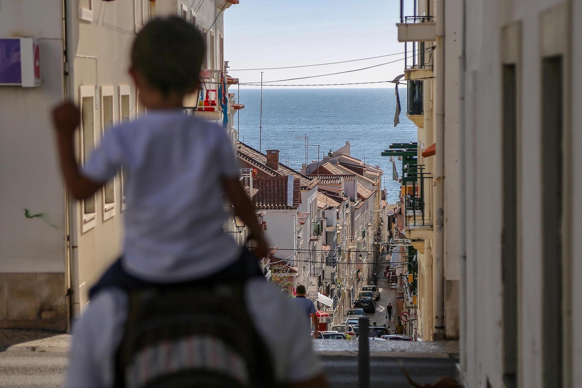
A vila da Nazaré é constituída por 3 núcleos populacionais importantes: Praia, Sítio e Pederneira, e pela povoação de Fanhais.
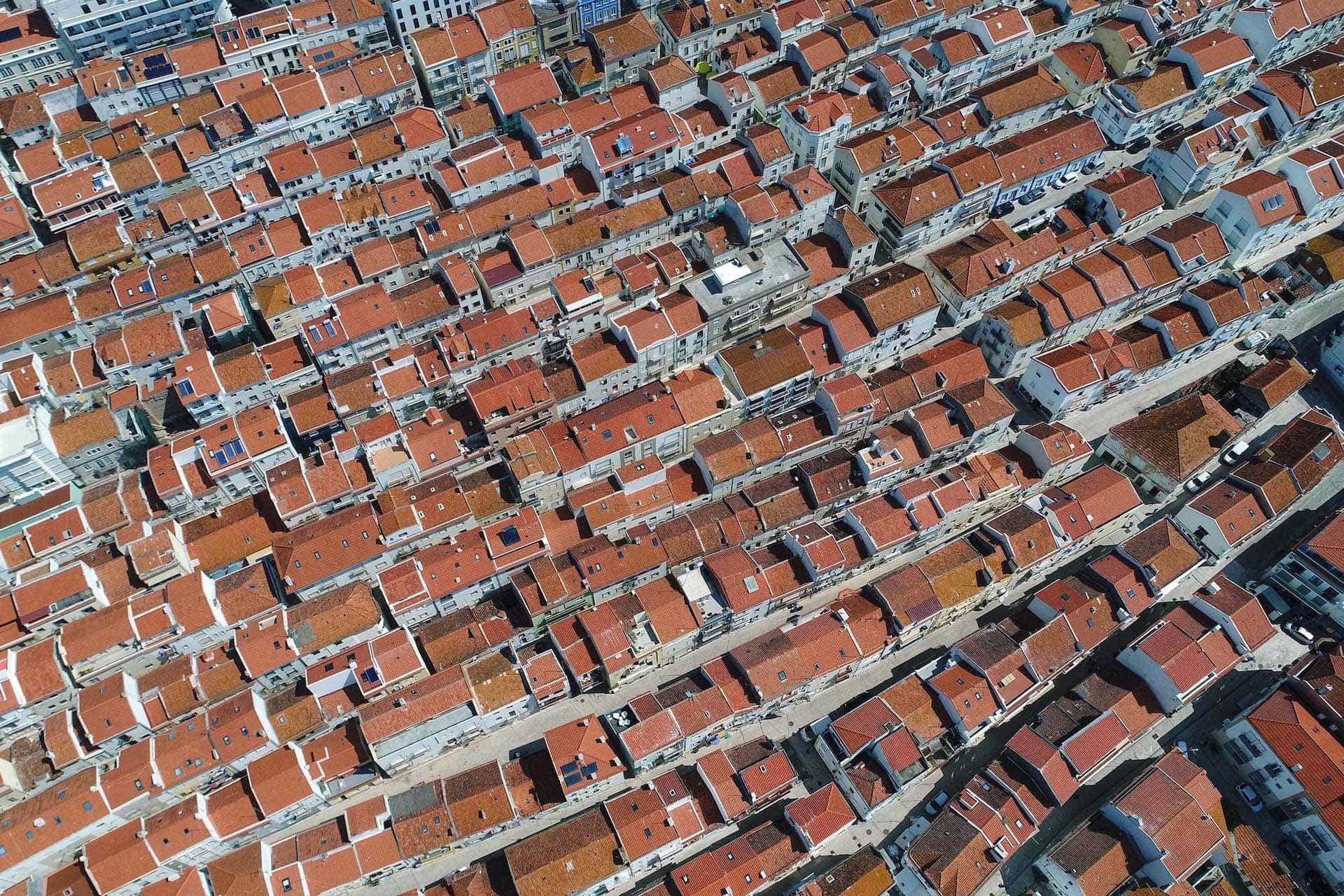
The name Nazaré is attributed, since 1912, to the urban complex formed by the historic centres of Praia, Sítio and Pederneira, with different chronological and community origins, and which are urbanistically interconnected.
This connection comes from its natural expansion, but above all, more recently, from the creation of new residential areas, such as Urbisol, Rio Novo and Nova Nazaré.
The municipality of Nazaré consists of 3 parishes: Nazaré, Valado dos Frades and Famalicão, it has an area of 82.5 km2, about 15,000 inhabitants and one of the most famous beaches on the Portuguese coast.
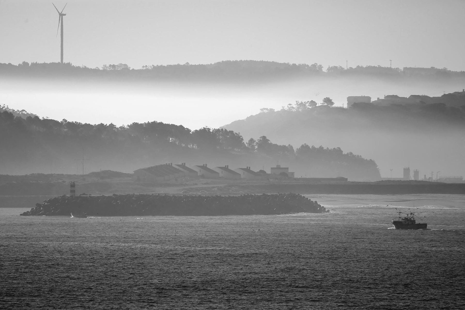
Most of the area of the municipality is made up of flat and sandy terrain, with some patches originating from old silts that formed after the receding of the sea. Coarse, clean sand is found shallow.
To the north of the Municipality the land is made up of dunes covered with pine trees, with some cultivated and productive lowlands. The entire horticultural culture has a great development, especially in the very fertile fields of Valado, and where a true tradition remains from the monks of the Monastery of Alcobaça
A pesca absorvia a maior parte das actividades humanas, tanto a pesca junto à costa como a de alto mar. Hoje em dia, apesar das actividades piscatória e agrícola permanecerem no concelho, a actividade turística tem vindo a monopolizar grande parte dos recursos humanos do município.